

Lowrance C-MAP Lakes South East Max-N+
| Manufacturer | C-MAP | |
| MFG NO | M-NA-Y074-MS | |
| SKU | 5960117 | |
| UPC | 9420064103669 |
- SUMMARY
- SPECIFICATIONS
- MANUFACTURER
- REVIEWS
Lowrance C-MAP Lakes South East Max-N+
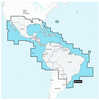
High-Resolution Bathymetric (HRB) bottom contour and fishing charts to help anglers target fish-holding coastal and offshore structure more effectively. The C-MAP Lakes South East Max-N+ Chart is on a SD/Micro-SD Card, with vector charts, hi-res bathy data, tides & currents, and port info. This will work on B and G, Simrad, and Lowrance only.|.04|5.12|4.33|.08|Dynamic Tides and Currents predictions that help anglers determine the best times to hit productive rips, shoals, rocks and channels|Aerial photos and worldwide database of Marina Info/Port Services great for cruisers, sailors, and traveling fishermen|Sport Fishing Data for valuable information on wrecks and reefs, including composition, depth, orientation and other details to fish more effectively|High-resolution satellite imagery to enhance situational awareness and improve safety|Dynamic Raster Charts for a traditional paper chart look with the ability to pull up information on important chart objects|Shaded relief vector chart presentation highlights specific depth contours, valuable when cruising or fishing||F|N/A
Munufacturer: C-MAP
Model: M-NA-Y074-MS
SKU: SI_1123382
| Specification | Value | |
|---|---|---|
| MFG NO | M-NA-Y074-MS | |
| SKU | 5960117 | |
| UPC | 9420064103669 |
| C-MAP | ||
| Phone: | ||
| Email: | us-customersupport@c-map.com | |
| Website: | http://www.c-map.com | |
| Address: |
, |
|

|
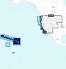
Garmin BlueChart; g3 HD - HXUS604x - US All & Canadian West - microSD™/SD™BlueChart® g3 HD - HXUS604x - US All & Canadian West - microSD™/SD™CoverageProvides detailed coastal coverage of the U.S., including the East Coast from Key West, FL, to the Canadi... |
||||||
|
FLAT SHIPPING!
|
|||||||
|
PRICE $197.99
QTY
ADD TO CART
|
|||||||
|
Garmin Navionics+™ Nssa004l - Mexico, The Caribbean To Brazil - Inland & Coastal Marine ChartNavionics+™ NSSA004L - Mexico, the Caribbean to Brazil - Inland & Coastal Marine ChartGet the world’s No. 1 choice in the marine mapping with the best, most up-to-date Navionics®+ ... |
||||||
|
FLAT SHIPPING!
|
|||||||
|
PRICE $134.99
QTY
ADD TO CART
|
|||||||
|
Garmin Navionics Vision+™ Nvus008r U.s. WestGarmin Navionics Vision+™ NVUS008R U.S. WestGet the world’s No. 1 choice in the marine mapping (based on 2020 reported sales) — with the best, most up-to-date Navionics®+ cartogr... |
||||||
|
FLAT SHIPPING!
|
|||||||
|
PRICE $134.99
QTY
ADD TO CART
|
|||||||
Lowrance C-MAP Lakes South East Max-N+
Lowrance C-MAP Lakes South East Max-N+High-Resolution Bathymetric (HRB) bottom contour and fishing charts to help anglers target fish-holding coastal and offshore structure more effectively. The C-MAP Lakes South East Max-N+ Chart is on a SD/Micro-SD Card, with vector charts, hi-res bathy data, tides & currents, and port info. This will work on B and G, Simrad, and Lowrance only.|.04|5.12|4.33|.08|Dynamic Tides and Currents predictions that help anglers determine the best times to hit productive rips, shoals, rocks and channels|Aerial photos and worldwide database of Marina Info/Port Services great for cruisers, sailors, and traveling fishermen|Sport Fishing Data for valuable information on wrecks and reefs, including composition, depth, orientation and other details to fish more effectively|High-resolution satellite imagery to enhance situational awareness and improve safety|Dynamic Raster Charts for a traditional paper chart look with the ability to pull up information on important chart objects|Shaded relief vector chart presentation highlights specific depth contours, valuable when cruising or fishing||F|N/A Munufacturer: C-MAPModel: M-NA-Y074-MS SKU: SI_1123382
Manufacturer C-MAP
Mfg No M-NA-Y074-MS
SKU 5960117
UPC 9420064103669

- Reloading
- Ammunition
- Optics
-
All Departments
- Air Guns & Accessories
- Ammunition
- Ammunition Accessories
- AR-15 Parts and Accessories
- Archery, Crossbows & Accessories
- Baseball and Softball Products
- Bikes and Scooters
- Blowguns and Sling Shots
- Books, Maps, and Videos
- Camping Gear
- Chemicals
- Choke Tubes & Tube Cases
- Climbing Gear
- Clothing, Hunting Apparel, and Footwear
- Electronics, Metal Detectors, GPS, Game Cameras, and Radios
- Eye and Hearing Protection
- Firearm Parts and Firearm Accessories
- Fishing Gear
- Flashlights, Lanterns, Lighting, and Head Lamps
- Food Preparation
- Gifts, Games, Toys, and Promotional Items
- Golf Products
- GPS Devices
- Gun Cases Rifle, Pistol, and Shotgun
- Gun Cleaning and Care Products
- Gun Safes & Accessories
- Gunsmithing Equipment and Products
- Health, Fitness, and First Aid Products
- Holsters & Accessories
- House and Cabin
- Hunting and Safari Trips
- Hunting Gear
- Insect Control
- Knives, Saws, Axes, and Accessories
- Lacrosse Products
- Law Enforcement and Training
- Marine and Boating
- Muzzleloaders, Accessories and Supplies
- New Products
- Night Vision and Thermal Vision Equipment
- Optics
- Pet Products
- Range Bags, Fanny Packs, Day Pack, Stuff Sack and Specialty Bags and Cases
- Reloading
- Shooting Gear
- Snap Caps and Dummy Ammuntition
- Targets & Throwers
- Travel Products
- Vehicle Accessories, ATV Accessories, and Game Carriers
- Water Sports Equipment
- Winter Gear and Accessories
- Winter Sports Equipment
- Zombie Gear
- Today's Deals
- LG-Outdoors Blog
- Craig Boddington on Calibers
- Fit Charts
- Search By Department
- Air Guns & Accessories
- Ammunition
- Ammunition Accessories
- AR-15 Parts and Accessories
- Archery, Crossbows & Accessories
- Baseball and Softball Products
- Bikes and Scooters
- Blowguns and Sling Shots
- Books, Maps, and Videos
- Camping Gear
- Chemicals
- Choke Tubes & Tube Cases
- Climbing Gear
- Clothing, Hunting Apparel, and Footwear
- Electronics, Metal Detectors, GPS, Game Cameras, and Radios
- Eye and Hearing Protection
- Firearm Parts and Firearm Accessories
- Fishing Gear
- Flashlights, Lanterns, Lighting, and Head Lamps
- Food Preparation
- Gifts, Games, Toys, and Promotional Items
- Golf Products
- GPS Devices
- Gun Cases Rifle, Pistol, and Shotgun
- Gun Cleaning and Care Products
- Gun Safes & Accessories
- Gunsmithing Equipment and Products
- Health, Fitness, and First Aid Products
- Holsters & Accessories
- House and Cabin
- Hunting and Safari Trips
- Hunting Gear
- Insect Control
- Knives, Saws, Axes, and Accessories
- Lacrosse Products
- Law Enforcement and Training
- Marine and Boating
- Muzzleloaders, Accessories and Supplies
- New Products
- Night Vision and Thermal Vision Equipment
- Optics
- Pet Products
- Range Bags, Fanny Packs, Day Pack, Stuff Sack and Specialty Bags and Cases
- Reloading
- Shooting Gear
- Snap Caps and Dummy Ammuntition
- Targets & Throwers
- Travel Products
- Vehicle Accessories, ATV Accessories, and Game Carriers
- Water Sports Equipment
- Winter Gear and Accessories
- Winter Sports Equipment
- Zombie Gear
- All Departments
- Air Guns & Accessories
- Ammunition
- Ammunition Accessories
- AR-15 Parts and Accessories
- Archery, Crossbows & Accessories
- Baseball and Softball Products
- Bikes and Scooters
- Blowguns and Sling Shots
- Books, Maps, and Videos
- Camping Gear
- Chemicals
- Choke Tubes & Tube Cases
- Climbing Gear
- Clothing, Hunting Apparel, and Footwear
- Electronics, Metal Detectors, GPS, Game Cameras, and Radios
- Eye and Hearing Protection
- Firearm Parts and Firearm Accessories
- Fishing Gear
- Flashlights, Lanterns, Lighting, and Head Lamps
- Food Preparation
- Gifts, Games, Toys, and Promotional Items
- Golf Products
- GPS Devices
- Gun Cases Rifle, Pistol, and Shotgun
- Gun Cleaning and Care Products
- Gun Safes & Accessories
- Gunsmithing Equipment and Products
- Health, Fitness, and First Aid Products
- Holsters & Accessories
- House and Cabin
- Hunting and Safari Trips
- Hunting Gear
- Insect Control
- Knives, Saws, Axes, and Accessories
- Lacrosse Products
- Law Enforcement and Training
- Marine and Boating
- Muzzleloaders, Accessories and Supplies
- New Products
- Night Vision and Thermal Vision Equipment
- Optics
- Pet Products
- Range Bags, Fanny Packs, Day Pack, Stuff Sack and Specialty Bags and Cases
- Reloading
- Shooting Gear
- Snap Caps and Dummy Ammuntition
- Targets & Throwers
- Travel Products
- Vehicle Accessories, ATV Accessories, and Game Carriers
- Water Sports Equipment
- Winter Gear and Accessories
- Winter Sports Equipment
- Zombie Gear

- Search By Department
- Air Guns & Accessories
- Ammunition
- Ammunition Accessories
- AR-15 Parts and Accessories
- Archery, Crossbows & Accessories
- Baseball and Softball Products
- Bikes and Scooters
- Blowguns and Sling Shots
- Books, Maps, and Videos
- Camping Gear
- Chemicals
- Choke Tubes & Tube Cases
- Climbing Gear
- Clothing, Hunting Apparel, and Footwear
- Electronics, Metal Detectors, GPS, Game Cameras, and Radios
- Eye and Hearing Protection
- Firearm Parts and Firearm Accessories
- Fishing Gear
- Flashlights, Lanterns, Lighting, and Head Lamps
- Food Preparation
- Gifts, Games, Toys, and Promotional Items
- Golf Products
- GPS Devices
- Gun Cases Rifle, Pistol, and Shotgun
- Gun Cleaning and Care Products
- Gun Safes & Accessories
- Gunsmithing Equipment and Products
- Health, Fitness, and First Aid Products
- Holsters & Accessories
- House and Cabin
- Hunting and Safari Trips
- Hunting Gear
- Insect Control
- Knives, Saws, Axes, and Accessories
- Lacrosse Products
- Law Enforcement and Training
- Marine and Boating
- Muzzleloaders, Accessories and Supplies
- New Products
- Night Vision and Thermal Vision Equipment
- Optics
- Pet Products
- Range Bags, Fanny Packs, Day Pack, Stuff Sack and Specialty Bags and Cases
- Reloading
- Shooting Gear
- Snap Caps and Dummy Ammuntition
- Targets & Throwers
- Travel Products
- Vehicle Accessories, ATV Accessories, and Game Carriers
- Water Sports Equipment
- Winter Gear and Accessories
- Winter Sports Equipment
- Zombie Gear
| 0 | Total: $0.00 |
|
|

