

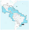
Navionics Platinum+ Npus005r U.s. North
| Manufacturer | Navionics | |
| MFG NO | 010-C1368-40 | |
| SKU | 6117934 | |
| UPC | 821245991751 |
- SUMMARY
- SPECIFICATIONS
- MANUFACTURER
- REVIEWS
NPUS005R U.S. NorthNavionics Platinum+™ charts include all the content of Navionics®+ cartography, with integrated offshore and inland mapping, 42,000+ lakes and additional viewing options for relief shading, satellite imagery with SonarChart shading overlay, 3D perspective view, aerial photos, and more.Charts & Updates:Nautical Chart – Comprehensive charts are derived from multiple officials, government, and private sources, displayed in a familiar look and feelSonarChart HD Bathymetry – Innovative 1' (0.5 m) bathymetry charts are created by using Navionics proprietary systems that augment existing content with sonar data contributed by the boating communityCommunity Edits – Get useful local knowledge from edits made by users of the Navionics Boating app on your compatible smart device.Daily Updates – Up to 5,000 daily updates to our charts give you the most accurate, most current Navionics data available.Advanced Features:Dock-to-dock Route Guidance – Start your trip with a suggested path.SonarChart Live Mapping Feature – Watch new HD depth maps develop in real-time as your boat moves through the water.Advanced Map Options – Customize your view to focus on the details that matter mostPlotter Sync – Transfer routes and markers, update chart layers, and more — between your compatible chartplotter and the Boating app.Overlays:Relief Shading – Get an easy-to-interpret, clearer view of bottom structure.Satellite Imagery with SonarChart Shading Overlay – Experience an enhanced awareness above and below the waterline.Sonar Imagery – View bottom hardness clearly and in contrasting color. Platinum+ Additional Viewing Options:3D View – Adjust the perspective of your chart view to highlight key features and enhance awarenessAerial Photos – Get a better sense of your surroundings.Coverage Areas:Worldwide map coverage is available, with integrated content making it easier to select the navigation features and map regions you want. Choose from large coverage areas (Large) to more localized chart cuts (Regular).Compatibility:Check the compatibility of Platinum+ content and features with your GPS chartplotter.1 Subscription is required.2 Dock-to-dock Route Guidance is for planning purposes only and does not replace safe navigation operations.3 Subscription not required for SonarChart Live mapping feature on some chartplotter models; requires latest chartplotter firmware release. NOTE: Navionics+ and Platinum+ cards are not compatible with Garmin chartplotters.**NOT FOR USE IN GARMIN CHARTPLOTTERS**
| Specification | Value | |
|---|---|---|
| MFG NO | 010-C1368-40 | |
| SKU | 6117934 | |
| UPC | 821245991751 |
| Navionics | ||
| Phone: | ||
| Email: | ||
| Website: | http://www.navionics.com/en | |
| Address: |
, |
|

|
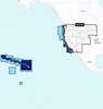
Garmin BlueChart; g3 HD - HXUS604x - US All & Canadian West - microSD™/SD™BlueChart® g3 HD - HXUS604x - US All & Canadian West - microSD™/SD™CoverageProvides detailed coastal coverage of the U.S., including the East Coast from Key West, FL, to the Canadi... |
||||||
|
FLAT SHIPPING!
|
|||||||
|
PRICE $197.99
QTY
ADD TO CART
|
|||||||
|
Garmin Navionics+™ Nssa004l - Mexico, The Caribbean To Brazil - Inland & Coastal Marine ChartNavionics+™ NSSA004L - Mexico, the Caribbean to Brazil - Inland & Coastal Marine ChartGet the world’s No. 1 choice in the marine mapping with the best, most up-to-date Navionics®+ ... |
||||||
|
FLAT SHIPPING!
|
|||||||
|
PRICE $134.99
QTY
ADD TO CART
|
|||||||
|
Garmin Navionics Vision+™ Nvus008r U.s. WestGarmin Navionics Vision+™ NVUS008R U.S. WestGet the world’s No. 1 choice in the marine mapping (based on 2020 reported sales) — with the best, most up-to-date Navionics®+ cartogr... |
||||||
|
FLAT SHIPPING!
|
|||||||
|
PRICE $134.99
QTY
ADD TO CART
|
|||||||
Navionics Platinum+ Npus005r U.s. North
NPUS005R U.S. NorthNavionics Platinum+™ charts include all the content of Navionics®+ cartography, with integrated offshore and inland mapping, 42,000+ lakes and additional viewing options for relief shading, satellite imagery with SonarChart shading overlay, 3D perspective view, aerial photos, and more.Charts & Updates:Nautical Chart – Comprehensive charts are derived from multiple officials, government, and private sources, displayed in a familiar look and feelSonarChart HD Bathymetry – Innovative 1' (0.5 m) bathymetry charts are created by using Navionics proprietary systems that augment existing content with sonar data contributed by the boating communityCommunity Edits – Get useful local knowledge from edits made by users of the Navionics Boating app on your compatible smart device.Daily Updates – Up to 5,000 daily updates to our charts give you the most accurate, most current Navionics data available.Advanced Features:Dock-to-dock Route Guidance – Start your trip with a suggested path.SonarChart Live Mapping Feature – Watch new HD depth maps develop in real-time as your boat moves through the water.Advanced Map Options – Customize your view to focus on the details that matter mostPlotter Sync – Transfer routes and markers, update chart layers, and more — between your compatible chartplotter and the Boating app.Overlays:Relief Shading – Get an easy-to-interpret, clearer view of bottom structure.Satellite Imagery with SonarChart Shading Overlay – Experience an enhanced awareness above and below the waterline.Sonar Imagery – View bottom hardness clearly and in contrasting color. Platinum+ Additional Viewing Options:3D View – Adjust the perspective of your chart view to highlight key features and enhance awarenessAerial Photos – Get a better sense of your surroundings.Coverage Areas:Worldwide map coverage is available, with integrated content making it easier to select the navigation features and map regions you want. Choose from large coverage areas (Large) to more localized chart cuts (Regular).Compatibility:Check the compatibility of Platinum+ content and features with your GPS chartplotter.1 Subscription is required.2 Dock-to-dock Route Guidance is for planning purposes only and does not replace safe navigation operations.3 Subscription not required for SonarChart Live mapping feature on some chartplotter models; requires latest chartplotter firmware release. NOTE: Navionics+ and Platinum+ cards are not compatible with Garmin chartplotters.**NOT FOR USE IN GARMIN CHARTPLOTTERS**
Manufacturer Navionics
Mfg No 010-C1368-40
SKU 6117934
UPC 821245991751

- Reloading
- Ammunition
- Optics
-
All Departments
- Air Guns & Accessories
- Ammunition
- Ammunition Accessories
- AR-15 Parts and Accessories
- Archery, Crossbows & Accessories
- Baseball and Softball Products
- Bikes and Scooters
- Blowguns and Sling Shots
- Books, Maps, and Videos
- Camping Gear
- Chemicals
- Choke Tubes & Tube Cases
- Climbing Gear
- Clothing, Hunting Apparel, and Footwear
- Electronics, Metal Detectors, GPS, Game Cameras, and Radios
- Eye and Hearing Protection
- Firearm Parts and Firearm Accessories
- Fishing Gear
- Flashlights, Lanterns, Lighting, and Head Lamps
- Food Preparation
- Gifts, Games, Toys, and Promotional Items
- Golf Products
- GPS Devices
- Gun Cases Rifle, Pistol, and Shotgun
- Gun Cleaning and Care Products
- Gun Safes & Accessories
- Gunsmithing Equipment and Products
- Health, Fitness, and First Aid Products
- Holsters & Accessories
- House and Cabin
- Hunting and Safari Trips
- Hunting Gear
- Insect Control
- Knives, Saws, Axes, and Accessories
- Lacrosse Products
- Law Enforcement and Training
- Marine and Boating
- Muzzleloaders, Accessories and Supplies
- New Products
- Night Vision and Thermal Vision Equipment
- Optics
- Pet Products
- Range Bags, Fanny Packs, Day Pack, Stuff Sack and Specialty Bags and Cases
- Reloading
- Shooting Gear
- Snap Caps and Dummy Ammuntition
- Targets & Throwers
- Travel Products
- Vehicle Accessories, ATV Accessories, and Game Carriers
- Water Sports Equipment
- Winter Gear and Accessories
- Winter Sports Equipment
- Zombie Gear
- Today's Deals
- LG-Outdoors Blog
- Craig Boddington on Calibers
- Fit Charts
- Search By Department
- Air Guns & Accessories
- Ammunition
- Ammunition Accessories
- AR-15 Parts and Accessories
- Archery, Crossbows & Accessories
- Baseball and Softball Products
- Bikes and Scooters
- Blowguns and Sling Shots
- Books, Maps, and Videos
- Camping Gear
- Chemicals
- Choke Tubes & Tube Cases
- Climbing Gear
- Clothing, Hunting Apparel, and Footwear
- Electronics, Metal Detectors, GPS, Game Cameras, and Radios
- Eye and Hearing Protection
- Firearm Parts and Firearm Accessories
- Fishing Gear
- Flashlights, Lanterns, Lighting, and Head Lamps
- Food Preparation
- Gifts, Games, Toys, and Promotional Items
- Golf Products
- GPS Devices
- Gun Cases Rifle, Pistol, and Shotgun
- Gun Cleaning and Care Products
- Gun Safes & Accessories
- Gunsmithing Equipment and Products
- Health, Fitness, and First Aid Products
- Holsters & Accessories
- House and Cabin
- Hunting and Safari Trips
- Hunting Gear
- Insect Control
- Knives, Saws, Axes, and Accessories
- Lacrosse Products
- Law Enforcement and Training
- Marine and Boating
- Muzzleloaders, Accessories and Supplies
- New Products
- Night Vision and Thermal Vision Equipment
- Optics
- Pet Products
- Range Bags, Fanny Packs, Day Pack, Stuff Sack and Specialty Bags and Cases
- Reloading
- Shooting Gear
- Snap Caps and Dummy Ammuntition
- Targets & Throwers
- Travel Products
- Vehicle Accessories, ATV Accessories, and Game Carriers
- Water Sports Equipment
- Winter Gear and Accessories
- Winter Sports Equipment
- Zombie Gear
- All Departments
- Air Guns & Accessories
- Ammunition
- Ammunition Accessories
- AR-15 Parts and Accessories
- Archery, Crossbows & Accessories
- Baseball and Softball Products
- Bikes and Scooters
- Blowguns and Sling Shots
- Books, Maps, and Videos
- Camping Gear
- Chemicals
- Choke Tubes & Tube Cases
- Climbing Gear
- Clothing, Hunting Apparel, and Footwear
- Electronics, Metal Detectors, GPS, Game Cameras, and Radios
- Eye and Hearing Protection
- Firearm Parts and Firearm Accessories
- Fishing Gear
- Flashlights, Lanterns, Lighting, and Head Lamps
- Food Preparation
- Gifts, Games, Toys, and Promotional Items
- Golf Products
- GPS Devices
- Gun Cases Rifle, Pistol, and Shotgun
- Gun Cleaning and Care Products
- Gun Safes & Accessories
- Gunsmithing Equipment and Products
- Health, Fitness, and First Aid Products
- Holsters & Accessories
- House and Cabin
- Hunting and Safari Trips
- Hunting Gear
- Insect Control
- Knives, Saws, Axes, and Accessories
- Lacrosse Products
- Law Enforcement and Training
- Marine and Boating
- Muzzleloaders, Accessories and Supplies
- New Products
- Night Vision and Thermal Vision Equipment
- Optics
- Pet Products
- Range Bags, Fanny Packs, Day Pack, Stuff Sack and Specialty Bags and Cases
- Reloading
- Shooting Gear
- Snap Caps and Dummy Ammuntition
- Targets & Throwers
- Travel Products
- Vehicle Accessories, ATV Accessories, and Game Carriers
- Water Sports Equipment
- Winter Gear and Accessories
- Winter Sports Equipment
- Zombie Gear

- Search By Department
- Air Guns & Accessories
- Ammunition
- Ammunition Accessories
- AR-15 Parts and Accessories
- Archery, Crossbows & Accessories
- Baseball and Softball Products
- Bikes and Scooters
- Blowguns and Sling Shots
- Books, Maps, and Videos
- Camping Gear
- Chemicals
- Choke Tubes & Tube Cases
- Climbing Gear
- Clothing, Hunting Apparel, and Footwear
- Electronics, Metal Detectors, GPS, Game Cameras, and Radios
- Eye and Hearing Protection
- Firearm Parts and Firearm Accessories
- Fishing Gear
- Flashlights, Lanterns, Lighting, and Head Lamps
- Food Preparation
- Gifts, Games, Toys, and Promotional Items
- Golf Products
- GPS Devices
- Gun Cases Rifle, Pistol, and Shotgun
- Gun Cleaning and Care Products
- Gun Safes & Accessories
- Gunsmithing Equipment and Products
- Health, Fitness, and First Aid Products
- Holsters & Accessories
- House and Cabin
- Hunting and Safari Trips
- Hunting Gear
- Insect Control
- Knives, Saws, Axes, and Accessories
- Lacrosse Products
- Law Enforcement and Training
- Marine and Boating
- Muzzleloaders, Accessories and Supplies
- New Products
- Night Vision and Thermal Vision Equipment
- Optics
- Pet Products
- Range Bags, Fanny Packs, Day Pack, Stuff Sack and Specialty Bags and Cases
- Reloading
- Shooting Gear
- Snap Caps and Dummy Ammuntition
- Targets & Throwers
- Travel Products
- Vehicle Accessories, ATV Accessories, and Game Carriers
- Water Sports Equipment
- Winter Gear and Accessories
- Winter Sports Equipment
- Zombie Gear
| 0 | Total: $0.00 |
|
|

